Railway corridors host complex networks of buried services essential to operations—power and signalling cables, telecommunications infrastructure, and drainage systems—alongside third-party utilities such as water, gas, and electricity mains. While many rail organisations maintain records of these installations, the documentation often proves incomplete, outdated, or spatially imprecise. This gap between assumed and actual conditions creates significant operational risks.
Unplanned contact with buried services during maintenance or construction activities can endanger personnel, disrupt critical railway systems, and trigger cascading delays to revenue services through emergency speed restrictions.
Project timescales and budgets rarely accommodate these contingencies, yet the consequences extend beyond immediate work: a severed signalling cable or ruptured utility can impact operations across entire route sections.
Beyond utilities
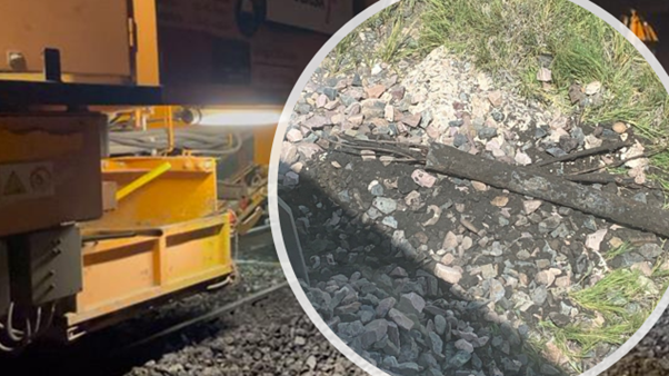
The challenge extends beyond mapped services. Track maintenance equipment—particularly ballast cleaners and undercutters—faces hazards from objects that historical records never captured: abandoned timber sleepers, shallow foundations from demolished structures, displaced fasteners, sections of old rail, and in some regions, unexploded ordnance.
When on-track machines encounter these obstructions, the results range from equipment damage to complete work stoppages.
The economic argument for pre-emptive detection becomes compelling when measured against the alternative: excavation delays, emergency repairs, and the opportunity cost of machines sitting idle while obstructions are manually cleared.
Detection methodology
Effective utility detection in the railway environment combines multiple geophysical techniques, each suited to specific target types. Ground penetrating radar deployed from rail-mounted platforms—trolleys, hi-rail vehicles, or RASC® platforms—enables continuous scanning.
Electromagnetic location complements GPR by tracing narrow-profile targets such as signalling cables and metallic pipes that may fall below radar detection thresholds. When combined with a sonde inserted into accessible utilities, electromagnetic methods can additionally track non-conductive targets including ceramic and concrete drainage systems.
While standard six-channel GPR systems excel at trackbed condition assessment and readily identify large-diameter cross-cutting services—comprehensive detection of smaller utilities and isolated obstructions demands purpose-built equipment.

High density array systems
A high density antenna array system addresses this requirement through spatial resolution rather than penetration depth alone. One system deploys up to 29 antennas across a two-metre swath, maintaining 75 mm transverse spacing while scanning at approximately 10 mm longitudinal intervals. This configuration generates a three-dimensional view of the trackbed volume, capturing targets from surface to depths approaching 1.5 metres in some ballast conditions.

Survey productivity can reach ten track kilometres per day in optimal conditions, though complex junctions or known congested areas warrant reduced speeds to maintain data quality.
Actual detection performance varies with ground conditions. Wet, clay-rich trackbeds attenuate radar signals more severely than clean, dry ballast. Heavily fouled ballast introduces scatter that can mask deeper targets. These physical limitations inform survey planning: areas where geological conditions or long-term fouling reduce penetration may require supplementary techniques or accept reduced detection depths.
Interpretation approach
Data interpretation employs hybrid methodology combining machine learning algorithms with manual verification by experienced geophysicists. Neural networks trained on extensive railway datasets provide initial target identification, flagging anomalies that match known utility signatures. These automated detections serve as a first filter, significantly accelerating the interpretation workflow while maintaining human oversight for ambiguous features.

This approach acknowledges that automated systems excel at pattern recognition across large datasets but require human judgment for context. An experienced interpreter distinguishes between a genuine cable and a ballast-subgrade interface mimicking similar radar characteristics—decisions that consider track history, known utility corridors, and the broader geophysical picture rather than isolated signatures alone.
Integration with operations
Survey outputs map directly to operational decisions. Engineers use detected utility depths to set excavation limits for maintenance activities, ensuring machines operate within safe margins above identified services. For construction projects, detailed utility positions inform foundation designs and enable pre-emptive removal of obstructions through traditional excavation or vacuum extraction techniques where track access permits.

The value proposition centres on converting uncertainty into quantified risk. Projects proceed with understood constraints rather than discovering them mid-execution, when options narrow and costs escalate.
This shift from reactive problem-solving to informed planning represents the fundamental case for systematic utility detection ahead of ground disturbance in the railway corridor.